Definition of a Route Guidance System for Android Smartphones

Definition of a Route Guidance System for Android Smartphones |
|
| Introduction | Framework | Installation | Options | Path computation |
About |
| Pedestrian is a free GPS navigation application for pedestrian in urban area that has the advantage of being permanently connected to a system taking advantages of an up to date street data base (OpenStreetMap). |
|
This application can be used in
any city of the world and can, moreover, in case of network
interruption for several minutes, continue to assist the user. One of the innovations of
this application is that the route computation is achieved by our
algorithms in an iterative way to make it more dynamic.
It is therefore not a roadmap but an evolutionary itinerary that proposes this application |
 |
Advertissement: the work presented has been achieved during
the training period of Benjamin Vincent in a rather short delay
and some bugs could remain unfixed. Let us note that some
interruptions of services could appear in the server.
|
|
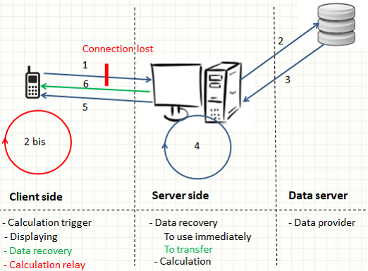
In
a client-server architecture the functions of the application
are achieved on a remote server in order to make the user's
application less expensive in CPU time and memory space.
Moreover, such an architecture requires a network and
therefore network connection problems between the
application and the server may cause undesired operation. To
compensate as much as possible this problem, our architecture
includes management of the loss of connection as long as it is
temporary.
The architecture in conventional mode is based on three parts illustrated by the diagram below :
 |
|
Computer scientists can refer to the API which offer services for shortest path compuation : http://www.isima.fr/~lacomme/ORWebServices/GPS4pedestrian/index.php
|
|
NB : : This application
requires Android version 3.0 or higher. (API level 11 +)
|
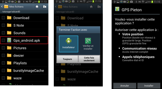
| Once the application file Gps_android.apk
downloaded, we must ensure that the smartphone allows installation of
an application that is not from the Android market. You
must go to the Security tab and allow Unknown sources. Then just install it on the mobile and enjoy... |
 |
| The application requires to activate GPS and mobile data on the device: |  |
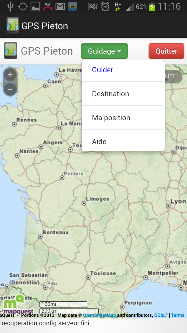
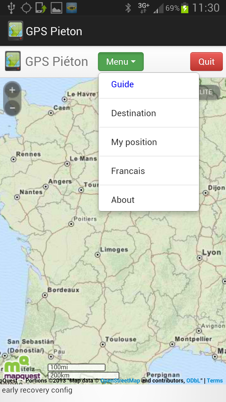
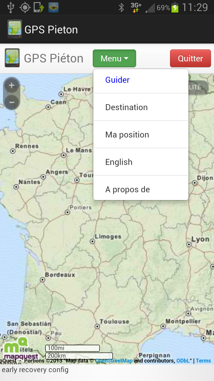
The functionalities of the application are available from the menu: |
 |
| My position : Center the map
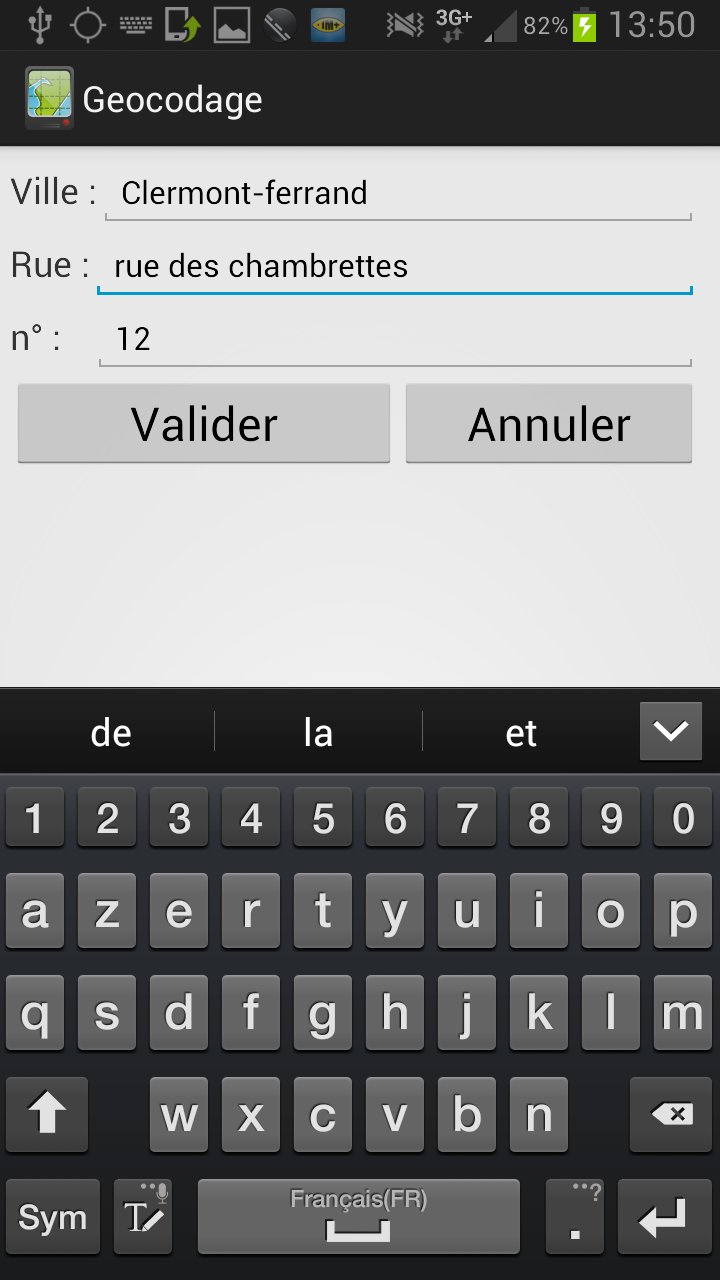
on the GPS location of the device Destination : Specify a postal address /td> | 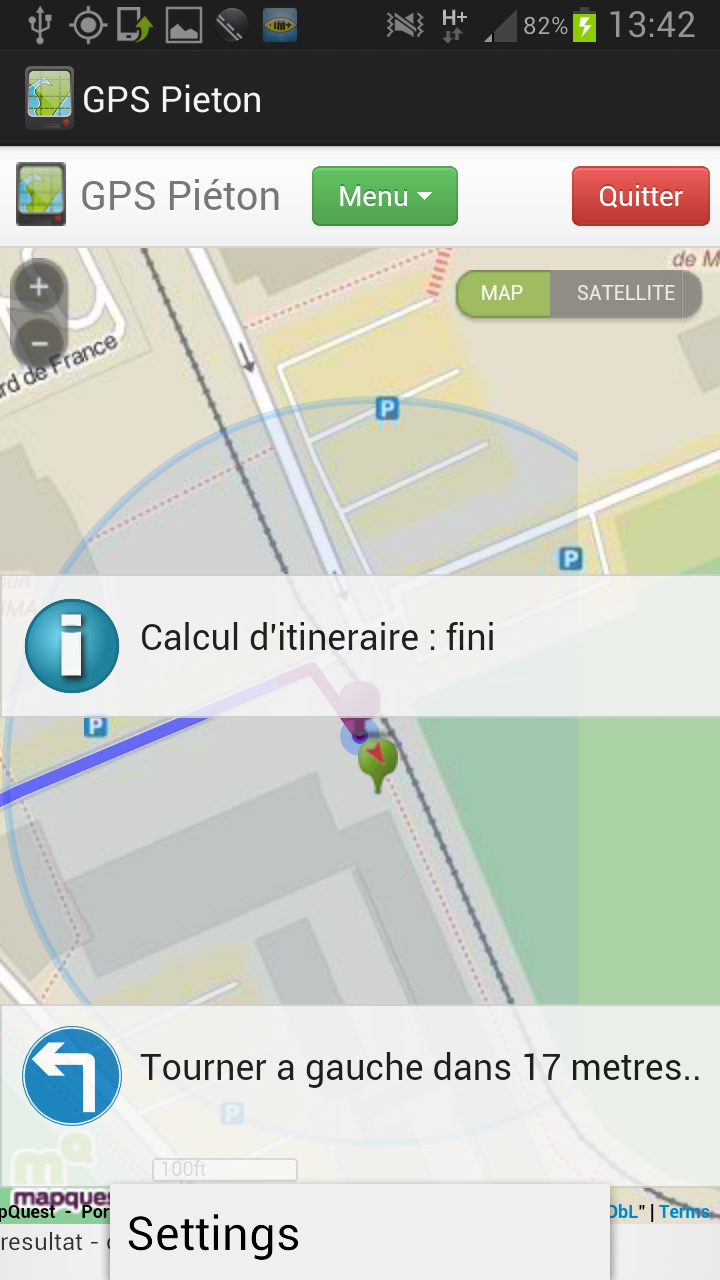 |
 |
| Guide : Starts computation of the trip | |
 |
| Language : It is possible to
switch the application in English or French. (the default language
is the language of the smartphone.) About : Some information on the application |
 |
 |
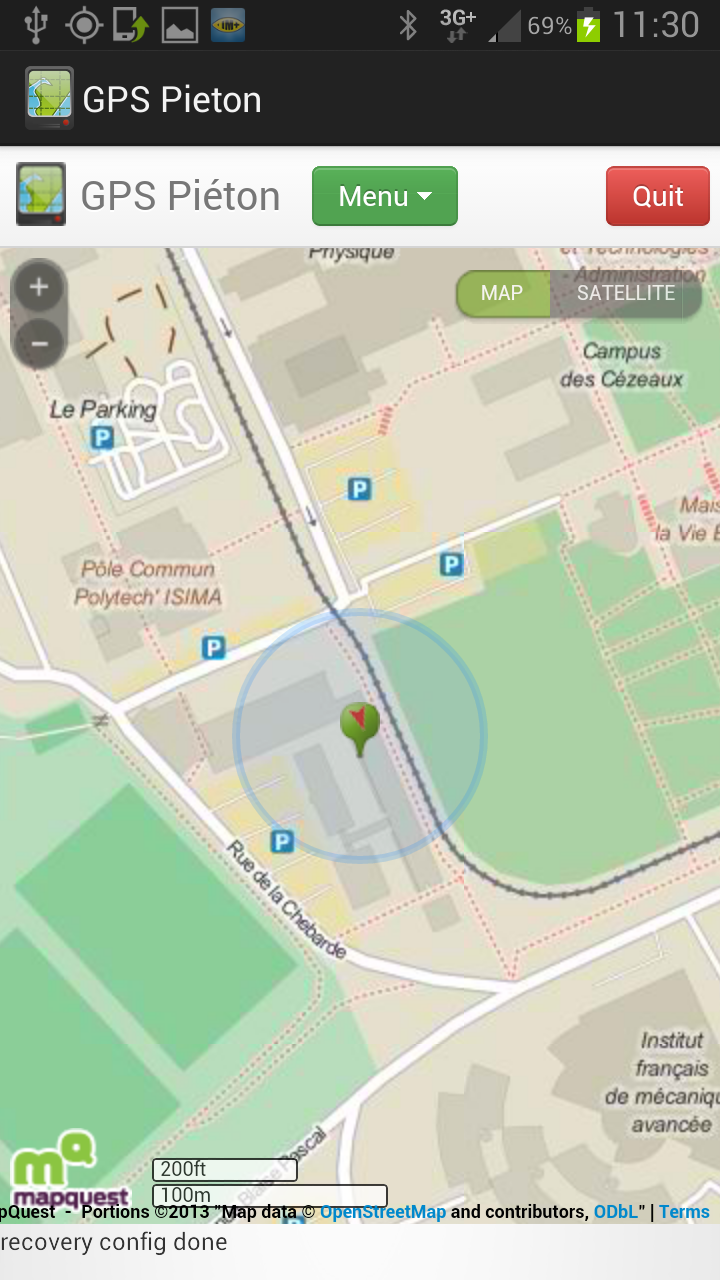
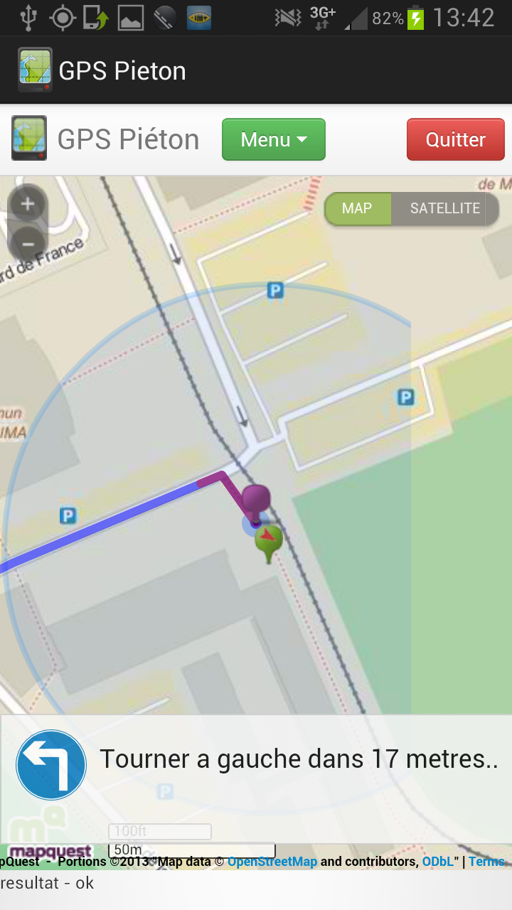
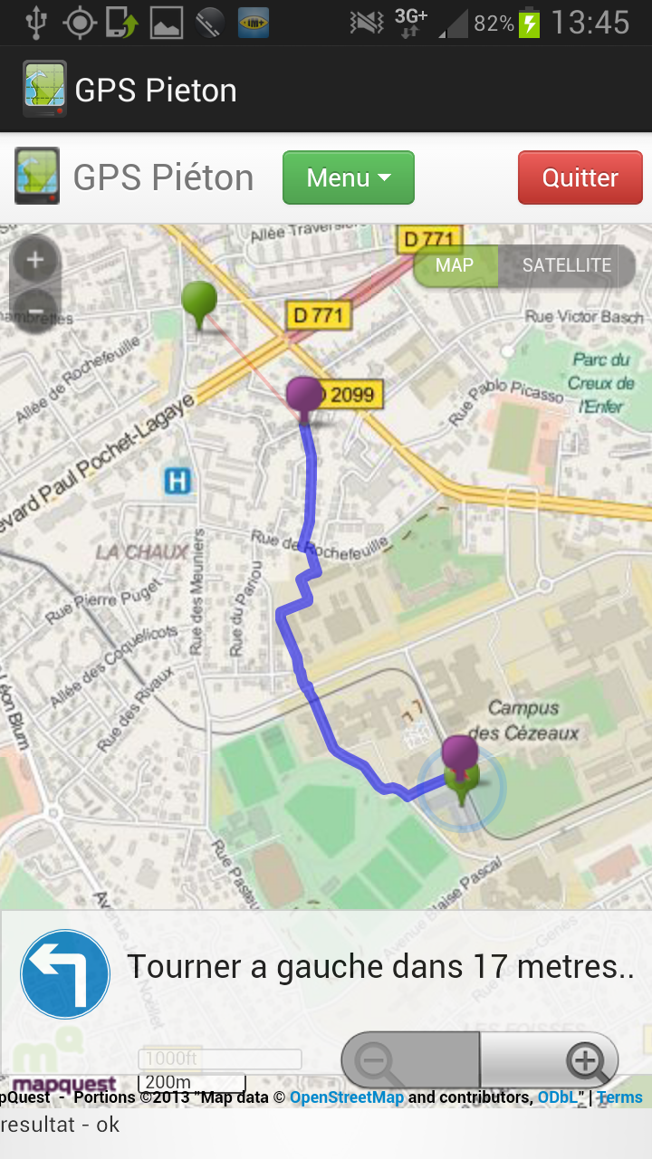
| The route calculation is achieved
iteratively. On the example, in reducing the zoom on the map it is possible to note that the route is not fully available (the green dot in the upper left is the destination), it will end when the user has covered a part of the first proposed route. |
 |
|
Dijkstra E.W. A note on two problems in Connexion with graph. Numerische Mathematik, Vol. 1, pp. 269-271. 1959. Golden B. Shortest Path Algorithms: A comparison. Operations Research, Vol. 24(6), 1976. Pallottino S. Shortest-Path methods: complexity, interrelations and new propositions. Networks. Vol 14(2). 1984. Gerhard Ert. Shortest Path calculation in large road networks. OR Spektrum. Vol 20. pp. 15-20. 1998. Wagner F. and T. Willahalm. Geometric Speed-Up Techniques for Finding Shortest Paths in Large Sparce Graphs. Konstanzer Scheriften in Mathematik. N. 183. ISSN: 1430-3558. 2003. Willahalm T. Engineering Shortest Paths and Layout Algorithms for Large Graphs. Dissertation. Doktors der Naturwissenschaften der Fakultat fur Informatik der Universitat Fridericiana zu Karlsruhe. 2005. Jung S. and Pramanik S. An Efficient Path Computation Model for Hierarchical Structured Topographical Road Maps. IEEE Transactions onKnowledge and Data Engineering. Vol. 14(5), October 2012. Wagner D. and Willahalm T. Geometric Containers for Efficient Shortest-Path Computation. ACM Journal of Experimental Algorithmics. Vol 10 (1.3.). pp. 1-30. 2005. |
AuthorBenjamin VINCENTbenjamin.vincent023@gmail.com Persons in charge of the training period:Libo REN
Ackowledgements:The team is grateful to ISIMA engineers for their help during this project.Fundings:This research was funded by the LABEX IMOBS3(Innovative MOBility: Smart and Sustainable Solutions)
Extra informationCartography : Mapquest / OpenStreetMapShortest path : Benjamin Vincent Server provided by: LIMOS Server JEE : Glassfish |